.png)
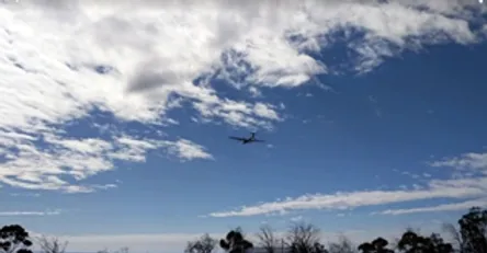
American Aerospace demonstrated remote sensing capabilities in a joint government-industry mock disaster exercise in California last November. (Image/ NOAA)
So far this year, there have been reports of nine major pipeline accidents affecting oil or gas providers in the U.S. Threats to pipeline infrastructure — the result of natural disasters or accidental infrastructure damage — continue. In past years, the loss of life and costs in terms of damages, liability costs lost revenue and replacement costs have been devastating and astronomical to the energy industry — averaging $354 million annually in the past 20 years, according to the Pipeline and Hazardous Materials Safety Agency. Clearly, the pace and rising costs of pipeline accidents, not to mention other perils facing the energy industry, require a big leap forward in threat detection. That’s where advanced airborne intelligence comes in. It’s a subject I will be addressing at EnerGIS, a conference to be held April 26 and 27 in Canonsburg, PA. It is sponsored by the Geospatial Information & Technology Association and will feature “inspiring and challenging talks about GIS (geographic information systems) within the energy industry.” My presentation, entitled “Applications of Near Real-time Remote Sensing in the Energy Sector” is scheduled for Friday (4/27). At American Aerospace, we are leading the way with systems that operate on both manned and unmanned aircraft and the capability to automatically report threat information to command centers and field personnel in near real time. American Aerospace is the only company in the U.S. that has developed an airborne service that uses advanced threat detection systems and 4G LTE technology to deliver the capability. It’s called InstiMaps. InstiMaps enables the rapid dissemination of remote sensing data to specialists across an enterprise. It can help to improve the safety and integrity of energy sector and other infrastructure. It can also help to speed response to disasters, saving lives, reducing property damage and environmental impacts. Applications include pipeline patrol, oil spill patrol and response, and response to natural and man-made disasters. Most recently, American Aerospace participated in an unmanned aircraft system exercise with a host of industry, federal and state partners in Goleta, CA. The oil spill patrol and response exercise in the Santa Barbara Channel last November demonstrated InstiMaps’ ability to provide offshore and shoreline map-based imagery in near real time from long endurance Unmanned Aircraft System flying Beyond Visual Line of Site (BVLOS) to NOAA’s GIS-based mapping application to validate new workflows that can accelerate tasking to cleanup crews. https://youtu.be/womGUxiP-Fk I look forward to sharing our progress and leadership in this field at the EnerGIS conference in Canonsburg, PA. Hope to see you there! #### #5g #uav #pennsylvania #energis #conshohocken #Verizon #energy #drones #4g #gas #pipeline #technology #oil#emergencyresponse #wildfire #petroleum #verizonwireless #conference #lte #instimaps #refinery #newjersey